Paper maps are a last resort for us when trying to get anywhere off pavement. We rely on our GPS system to rapidly pinpoint our location and mark us on the map in real time. It means the difference between having to take 5 minutes to plan out a route, versus twice as long to flip through paper maps. But, what happens if you primary GPS system fails? Chances are that you are going to have a less than enjoyable time if you have to spend the rest of a long trip meticulously tracking yourself on a paper map.
Since most of us have a smartphone with GPS, it is a good idea to set them up as a backup system in case this happens. We’ve tried several options for offline and off-road navigation on our Android based smartphones, but the fastest, easiest, and ultimately best solution as a backup has been Google Maps. As of Google Maps version 5.0, you can download pretty large sections of maps for offline use. The sections do have a size limit (though fairly large), but you can download multiple sections to cover entire states. Most importantly, the downloads are fast and the map file sizes are the most reasonable! An entire state can download in a matter of minutes, and only take about 400MB of space.
Here is a walk-through of how easy it is to setup an offline map in Google Maps:
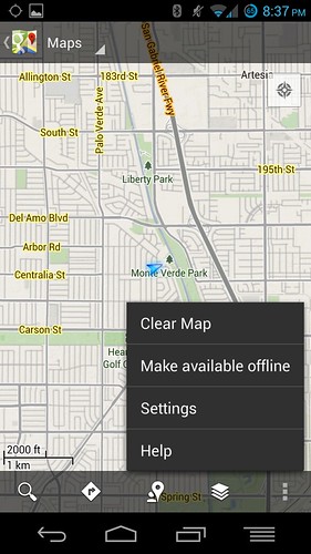
- Open up Google Maps and at the menu, you will see an option to “Make Available Offline” as shown here:
- Selecting that option will bring you to the following screen where you can highlight a square area to make available offline:
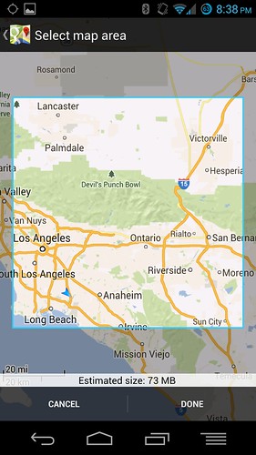 Notice that the area selected here is around 100 square miles and only takes up 73MB of space even for dense metro areas.
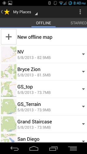
 - Your map will then download quickly and become a part of your Offline Maps list, which contains a list of your maps and the space they are using on your device.
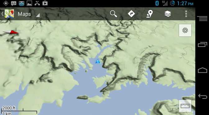
- And here is a shot of an offline Google Terrain Map in use at the Grand Staircase Escalante National Monument in Utah. Notice the nice details on the terrain, and the blue arrow icon that shows it actively tracking our position.

The Google Maps are much nicer than the maps on our Garmin device, and with a large 1080p screen on our Android smartphone, it was also more pleasant to look at. Most importantly, these backup maps for our trip were downloaded quickly when we had service and were ready to use when needed. We didn’t know our destination on this trip, so we downloaded all of the Grand Staircase area, Bryce and Zion in Utah, and all the surrounding areas to help us navigate. Since Google is always updating their maps, we find it useful to have a copy of their maps in case something not in our Garmin comes up, we can reference yet another source.